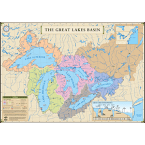
Description
25″ High x 36″ Wide Poster
Full color map of the entire Great Lakes region from Lake Superior through the St. Lawrence Seaway.
The map includes latitude & longitude lines; major rivers and cities in Great Lakes states and provinces; the drainage basin, depth, width, elevation, volume of flow, average precipitation & evaporation for each lake.
For futher information about the physical characterics of the Great Lakes, visit:
The Great Lakes
Great Lakes: An Environmental Atlas and Resource Book
Great Lakes Environmental Research Lab
Great Lakes Bathymetry